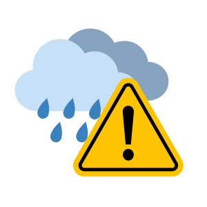
Weather Alert: Orange level warning – Rain
Please be advised of this weather alert put out by Fraser Health.
Orange Level Warning – Rain
Issued at 2025-12-09 11:16 by Environment and Climate Change Canada
Issued for
- Fraser Valley – central including Chilliwack and east including Hope, Hope Slide and Highway 3 – Hope
- An atmospheric river will be heavy rain and warm air, likely resulting in high streamflows and localized flooding
Current details
- Localized flooding is likely. Some roads may become impassable. Visibility will likely be suddenly reduced at times.
- Find further details here: Weather Alerts
Timeframe: Tuesday evening through Wednesday evening
An Orange warning means severe weather is likely to cause significant damage, disruption, or health impacts.
—
Flood Watch
Issued at 2025-12-09 12:00 by River Forecast Centre
Issued for
- Lower Fraser tributaries including Fraser Valley around Abbotsford, Chilliwack, Hope and east through Manning Park
Current details
- This event is potent, but it is projected to shorter in duration with less precipitation as the 2021 year event, and is forecasted to be concentrated more south of the border.
- In addition to the anticipated atmospheric river high rainfall, shallow snowpack is being observed around the mid and upper elevations of the region, with conditions to produce rain-on-snow and additional streamflow runoff.
- Rivers have risen from rainfall yesterday and overnight and remain high.
- Current modelling is indicating the potential for flows to reach the 5-year to 20-year return period range or higher.
- Stay clear of the banks of swift running rivers and never drive across flooded roads, bridges or river crossings. At this time of year leaves can clog storm drains and impact urban drainage. Keep storm drains clear.
Timeframe: Tuesday evening through Wednesday evening
A Flood Watch means that river levels are rising and will approach or may exceed bankfull. Flooding of areas adjacent to affected rivers may occur.
_____________________________________
Potential impacts for consideration
- Travel – Major travel disruption to services and transportation in the region is possible
- Staff may have trouble accessing work sites
- There may be delays to transport of patients and supplies
- Communities may be inaccessible
- Utilities and services – Utilities and services likely impacted
- Loose objects may be tossed by the wind and cause injury or damage
- High winds may result in power outages and fallen tree branches
- Power loss can lead to pump failures
- Land and structures – Substantial property damage
- Sudden rise in stream levels and localized flooding in residential and business areas
- Can increase likelihood of Code Grey internal flooding
- Human health – There may be an increased demand on health care services
- There is a potential for higher number of visits in Emergency Departments
- There is a possibility for delays from BCEHS and 911 dispatchers
- Prioritization of client/patient/resident wellness checks should consider priority populations
Potential actions to take
- Sign up for weather alerts through Alertable, WeatherCAN, and AlertMe
- Make sure on-call leadership is aware and knows how to report any impacts
- Be aware of plans that support the impacts of flooding and power failures
- Give yourself more time to travel for work
- Consider postponing non-essential travel until conditions improve